
The complete packet is below. The following information is typed out and included for the seeing impaired.
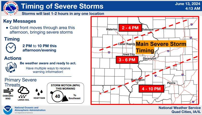
â— Confidence is high in the time being within 2-10 PM
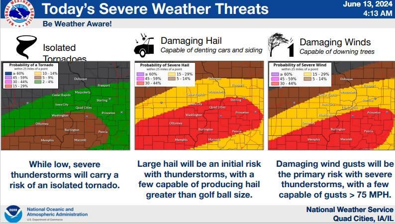
â— The primary risks with severe storms are large hail and damaging winds, some of which may be significant
â— Also Thursday will bring 95-100 ° heat indices south of U.S. Highway 30
â— Be weather aware, and also demonstrate heat safety!
Thursday Storm Timing Information
Storms will last 1-2 at any location
Cold front moves through area this afternoon bringing severe storms
2:00 PM - 10:00 PM Thursday Scattered / Widespread Coverage
â— Showers and thunderstorms will redevelop along a passing cold front Thursday afternoon and evening
â— Confidence of severe weather during this period is medium
â— The primary risks with this round of storms is damaging winds and large hail, with a low risk of tornadoes
The day before severe weather, make sure can receive Weather Emergency Alerts, adjust your plans and make sure your shelter is clean and accessible.
The day of...
Remain vigilant and aware of any active watches. A warning may be issued at a moment's notice. Remind your family of the communication plan, when a warning is issued you may only have seconds to take action.
June 12, 2024 2:07 p.m.
Enhanced Risk
Numerous severe storms possible.
Some longer lived severe storms---a few intense storms possible.
Seek shelter immediately if a warning is issued.
Comments
Submit a CommentPlease refresh the page to leave Comment.
Still seeing this message? Press Ctrl + F5 to do a "Hard Refresh".