-

-
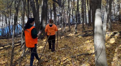 Conservation staff collecting GPS coordinates at Minne Estema State Park
By Layla Lynch, East Unit Park Ranger
You may have heard the term “GIS”, but have you wondered what it really entails? Maybe you have wondered how the maps you use at county and state parks are created. Is someone guessing where a boat ramp or shelter is and just posting a symbol on a map image, or is that person going out to the areas and documenting the exact location through satellite points? Let’s dig into GIS and see how we use it at Benton County Conservation!
GIS, or Geographic Information Systems, is a technology that is used to create, manage, analyze, and map different types of data such as streets, buildings, vegetation, bodies of water, or any other points of interest. By using computer software that creates visual maps (think of Google Earth or your car GPS) and GIS equipment (usually a phone or tablet with bluetooth that can connect to satellites), a user can go out to different locations and mark different points of interest and add as much information as you’d like to input.
These points of interest are integrated into a visual map which allows people to more easily see, analyze, and understand patterns and relationships. For example: there is a unique plant species that we find growing at one of our properties. If we go out with our GIS equipment and add points to our online map to show where this plant was found, we may be able to see that this plant species tends to grow on north facing slopes. We can analyze a pattern and understand more about this plant species.
Since 1963, GIS has grown into a very useful tool among agriculture, real estate, government, and many more agencies, and we use it here, right in Benton County! Currently, we are working on creating area maps for our properties and campgrounds.
We could map out every tree and bench that each property has, but to make it simpler for a user to take in, we have created a list of key features we would like our maps to show, including camp sites, public restrooms, information kiosks, and playgrounds.
We are thrilled to share that all of our campground maps for 2025 are up to date on our county website at: https://www.bentoncountyia.gov/conservation/maps/ and we have several other BCCB property maps uploaded with more coming soon! These maps are available to be viewed while online, but you can also download them before you head out if you expect to lose phone service. Click on the link to see what each area offers and enjoy our Benton County natural areas!

Comments
Submit a CommentPlease refresh the page to leave Comment.
Still seeing this message? Press Ctrl + F5 to do a "Hard Refresh".